The first day I planned to go to the grand canyon, I slept in too much to get there at a decent hour. From my hotel in Flagstaff it is a 90 minute drive. So instead I spent the day hiking a little near Sedona. I still had 2 more days for the canyon, so I wasn't worried.
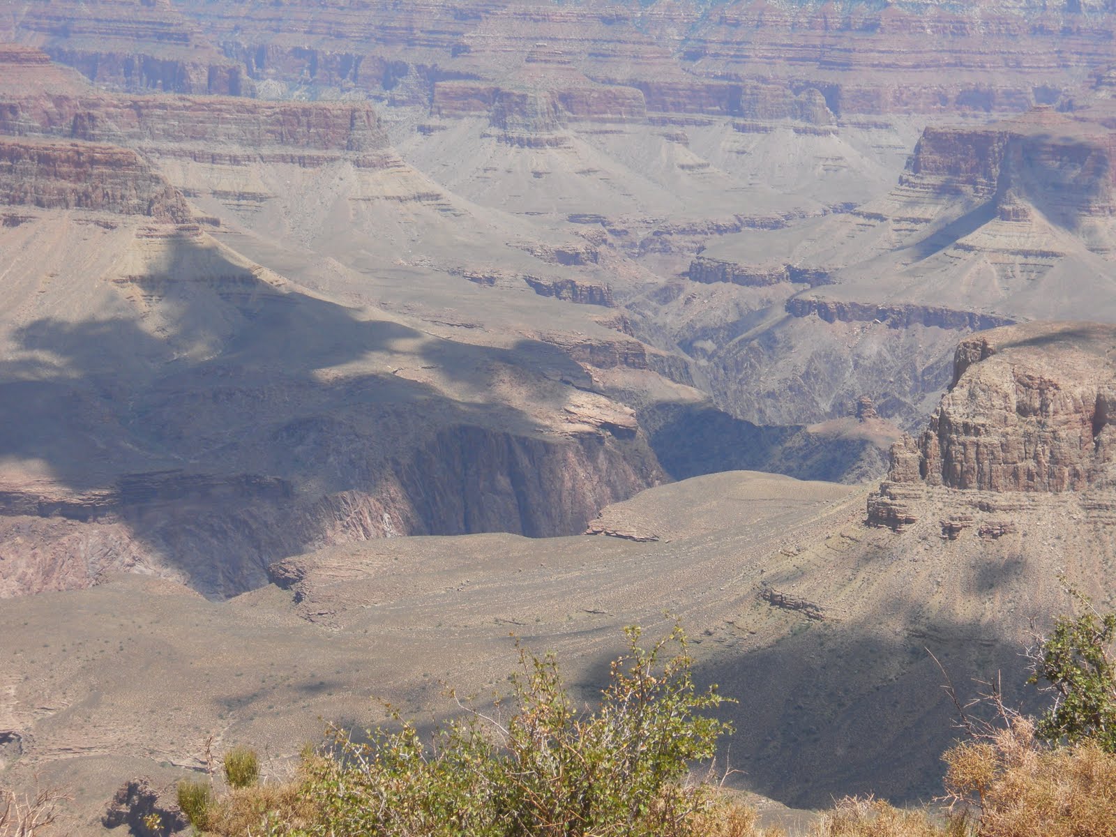
I found some nice views, like these.


And this close picture of a lizard.


All of this was just from the rim of the canyon, which is rather large. I looked around at the visitor center to find a trail for hiking into the canyon. Decided to take a trail rated "difficult". My other options for going into the canyon were "very difficult" and "most difficult".
They also like to warn you about a danger most other parks don't have. Its not falling, that is really rare. The problem is that you walk down before you walk up. This means some people get stuck from exhaustion. Several warnings exist telling you not to try going to the river and back in one day. It is too much for even very athletic people. There was even a ranger on the trail I went down asking people how far they were going and making sure they had enough supplies for the hike.
This is the start of the Kaibab trail I took. You can see some of the path on the left.


Much of the trail is about 2 steps from you falling off the edge. It takes a little getting used to.


I took this right after going down all those stairs. The slight zig-zag patter is the trail. You can even see a few people on it. Of course, these stairs looked awful on the way back up.


This is the first recommended stopping area. Its basically a nice view, but not that much room to rest.


This is cedar ridge, the second recommended stopping area. It has bathrooms, a good amount of space to rest, and some nice shaded trees. At this point I'm 1000 ft below the canyon and it feels warmer than the top did. There is about a 25 degree difference from the very top to the bottom.


Most people have a lunch at cedar ridge and go back up. I wanted to go a little farther. This next set of pictures is how far I made it. You can see this same rock 3 pictures above, only now I'm looking up at it instead of down.


That was the extent of how far down I made it. The trip back up was far too exhausting to think about pictures. I haven't been keeping up with my running, so my heart and lungs got tired easily. I had to really work at slowing my legs down to keep a decent pace. My first couple of starts back up just resulted in me resting after a minute or two of climbing.
Once I finally finished the rough trip back up, I decided I wanted to get into better shape and walk the entire canyon at some point. I now have a life goal of getting to the river and back without being one of those idiots that has to be rescued. I'll also need a stronger back, because the gallon of water I carried for this trip was tiring.
After I got back to the visitor center, I decided to take pictures of the board describing the trail I took. You can kinda see a little hill running along the red line pointing to cedar ridge. I think that's the rock I stopped at.


Beautiful pictures, I was so scared to even get close to the edge, no way was I hiking down. Did you go out on the new glass platform over the canyon?
ReplyDeleteThe pictures are wonderful. The trail looks scarier than you described the other day. I like the picture of the lizard. It kind of looks like the long tails we sell:P
ReplyDelete